
Here are a couple of pictures taken from our studios in the beautiful Embarcadero One building.
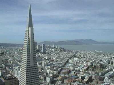 This is a shot looking North and to the West. Just to the right of the TransAmerica Pyramid Building is the Golden Gate Bridge. The hills to the right of the bridge are in Marin County. The first hill to the right of the bridge is Mt Beacon, where Alice's transmitter is located. The large mountain on the right side of the picture is Mt. Tamalpais.
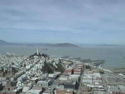 Now we are looking to the North. Near the center of the picture you can see Coit Tower. It's supposed to represent a nozzle from a fire hose but that story is just for the tourists. The small island to the right of Coit Tower is Alcatraz. The large island behind Alcatraz is Angel Island. Along the waterfront you can see many of San Francisco's piers. The land visible at the top right of the picture is Richmond.
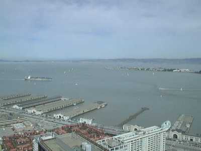 You can see some more of the waterfront in this shot. The spit of land in the middle right of the picture is Treasure Island. Treasure Island is a man made island constructed for the 1939 Worlds Fair. The land at the top of the picture is in the beautiful East Bay, Richmond, San Pablo, Albany, Berkeley.
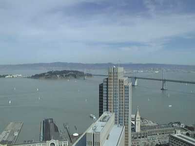 In this shot you can see some more of Treasure Island. The green island is Yerba Buena Island. The bridge is the Bay Bridge that connects Oakland to San Francisco. You can see the suspension side of the bridge in this shot. The bridge runs through the middle of Yerba Buena. On the Oakland side of Yerba Buena Island (YBI) the bridge is made up of cantilever sections. The buildings in front of you are Embarcadero Three and Four. The tower to the right of Embarcadero Four is the San Francisco Ferry Terminal.